Little Langdale
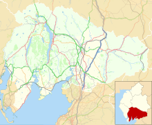
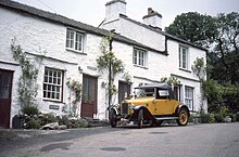
Valley in the Lake District, EnglandLittle Langdale is a valley in the Lake District, England, containing Little Langdale Tarn and a hamlet also called Little Langdale. A second tarn, Blea Tarn, is in a hanging valley between Little Langdale and the larger Great Langdale to the north. Little Langdale is flanked on the south and southwest by Wetherlam and Swirl How, and to the north and northwest by Lingmoor Fell and Pike of Blisco. The valley descends to join with Great Langdale above Elter Water.
Read article
Top Questions
AI generatedMore questions
Nearby Places

Elter Water
Lake in Cumbria, England

Lingmoor Fell
Fell in the Lake District, Cumbria, England

Elterwater
Village in England

Chapel Stile
Human settlement in England

Ting Mound
Ancient monument in the Lake District, Cumbria, England

Slater's Bridge
Packhorse bridge which crosses the River Brathay in Cumbria, England

Elterwater Bridge
Bridge at Elterwater, England

Britannia Inn
Pub in Cumbria, England


